Striking an unseen underground utility line – gas, electrical, or otherwise – can halt construction, create safety hazards, and lead to expensive repairs. Traditional utility maps are often outdated or inaccurate, making excavation a risky game of chance. However, Augmented Reality (AR) mapping is changing this, giving engineers the ability to visualize subsurface infrastructure with unprecedented precision.
This article explains how AR mapping works, the tools needed to implement it, and the benefits it brings to construction sites.
What is AR Mapping for Construction?
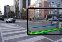
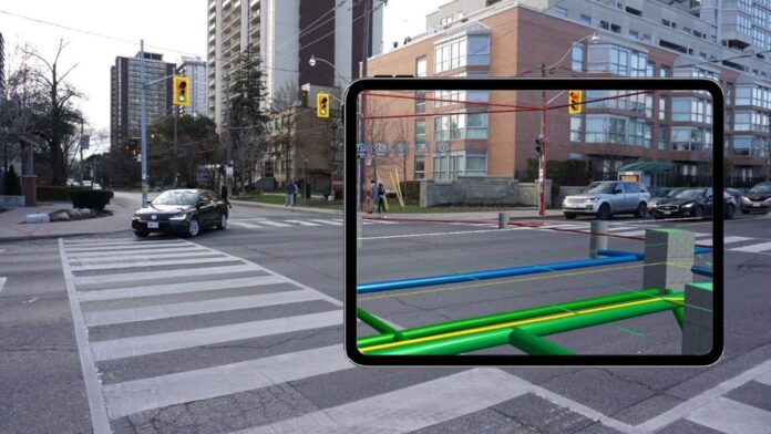
AR mapping overlays digital utility data directly onto a live view of the physical world, using a smartphone, tablet, or AR headset. Instead of referencing 2D plans, engineers can now see buried pipelines, cables, and ducts projected onto the ground in front of them – color-coded, labeled, and scaled to their actual location.
How Does it Work? The Core Technologies
AR utility visualization isn’t magic; it’s the convergence of four key technologies:
- Geospatial Utility Data: Accurate GIS or BIM data detailing the position, depth, and type of underground services.
- GNSS/GPS Positioning: Satellite-based positioning ensures that the AR display aligns with real-world coordinates.
- Mobile Device with AR Capability: A smartphone, tablet, or AR headset equipped with a camera and motion sensors.
- AR Software Engine: This app aligns the digital utility models to physical coordinates, updating the display as the user moves.
When an engineer points their device at the ground, the AR software superimposes 3D models of the buried utilities in real-time. This lets them “see through the ground,” identifying where each utility runs beneath their feet.
A Step-by-Step Guide to Using AR Mapping
Here’s how to implement AR utility visualization on-site:
- Data Collection and Preparation: Gather existing GIS, CAD, or BIM utility data from surveys, contractors, or government sources. Ensure the data includes coordinates and depth information. Clean and standardize the format (GeoJSON, DWG, or IFC are common).
- Software Integration: Import the data into an AR mapping platform like vGIS Utilities, Trimble SiteVision, Esri ArcGIS Field Maps (with AR add-ons), Augview, or Spectar AR. These tools convert 2D maps into 3D geo-referenced models.
- Calibration: Use a high-precision GNSS receiver to calibrate the AR environment. Align known site landmarks to ensure the digital model matches real-world coordinates accurately.
- Real-Time Visualization: Walk the site holding the device in front of you. The AR display will overlay underground utilities as colored 3D lines, labeled with type, depth, material, and ownership information.
- Capture and Share: Take screenshots, add notes, and create issue tags directly within the app. Share these annotated visuals instantly with design and excavation teams for coordination.
Why AR Mapping Matters: The Benefits
- Enhanced Safety: Knowing the precise location of buried utilities before excavation prevents accidental strikes, protecting workers and the public.
- Accurate Coordination: Engineers can verify utility relationships in real space, reducing clashes and costly rerouting.
- Time & Cost Savings: Eliminates reliance on outdated drawings and multiple site visits. A single AR scan can confirm the location of all services.
- Improved Communication: AR visuals are easy to understand, simplifying communication between contractors, designers, and clients.
- Integration with Existing Systems: Modern AR tools integrate with BIM and GIS databases, enabling digital twin creation for long-term asset management.
Equipment and Accuracy Considerations
For optimal results:
- Use survey-grade GNSS equipment for accuracy (within ±5 cm).
- Cross-check AR data with existing physical utility markings before excavating.
- Calibrate the AR environment using known control points.
- Avoid using AR under heavy cloud cover or metal structures, as GPS signals can be weak.
- Keep GIS/BIM data updated with any new installations or rerouting.
Is AR Mapping a Replacement for GPR?
Not entirely. AR mapping visualizes known utilities, while Ground Penetrating Radar (GPR) detects undocumented services. The most effective approach is to use both technologies together.
In conclusion, AR mapping is transforming how construction professionals interact with underground infrastructure. By bridging the gap between digital data and the physical world, it delivers significant safety improvements, cost savings, and enhanced coordination. As AR technology matures, it will become an essential tool for managing subsurface assets and minimizing risk on construction sites.


